landmark
Vale da Lua
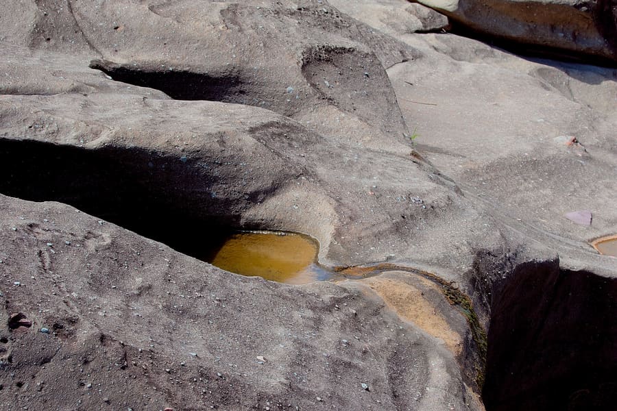
Smooth grey rock formations carved by the San Miguel River. Wear shoes with firm grip on wet stone.
Demander à ParleyBrésil
Quartz crystal trails and savanna waterfalls in Goiás.
introduction
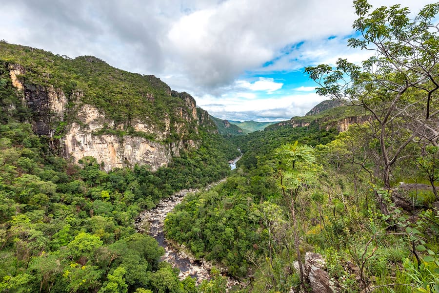
Alto Paraíso sits on a high plateau of solid quartz crystal in the Brazilian Cerrado. It serves as the primary regional base for exploring the Chapada dos Veadeiros. Expect long dirt-road drives, steep canyon walks, and chilly waterfall pools. Moving efficiently requires a personal vehicle with good ground clearance.
Airport connection
Brasília (BSB) is the closest major airport. Renting a car at BSB is far easier than taking local buses.
UNESCO Biosphere Reserve
The surrounding Cerrado ecosystem holds UNESCO Biosphere Reserve status. It protects thousands of endemic plant species.
Trail guides
Many trails inside the national park require no guide. Private properties along dirt roads frequently require hired guides.
Alto Paraíso de Goiás
MTur Destinos · Public domain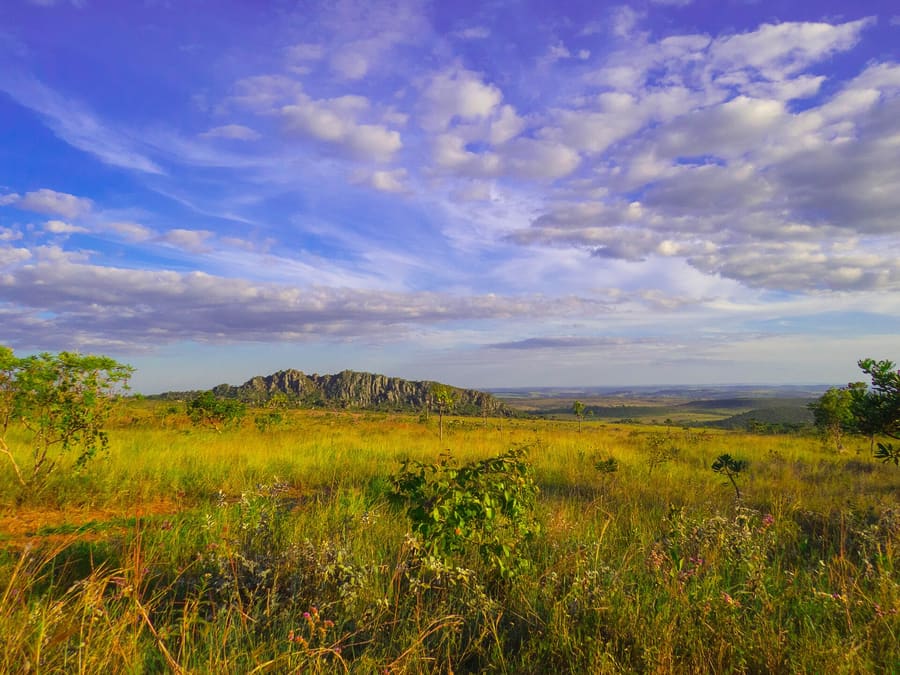
Highway Corridor — Secluded lodges and eco-resorts set in open Cerrado.
Angeladepaula · CC BY-SA 3.0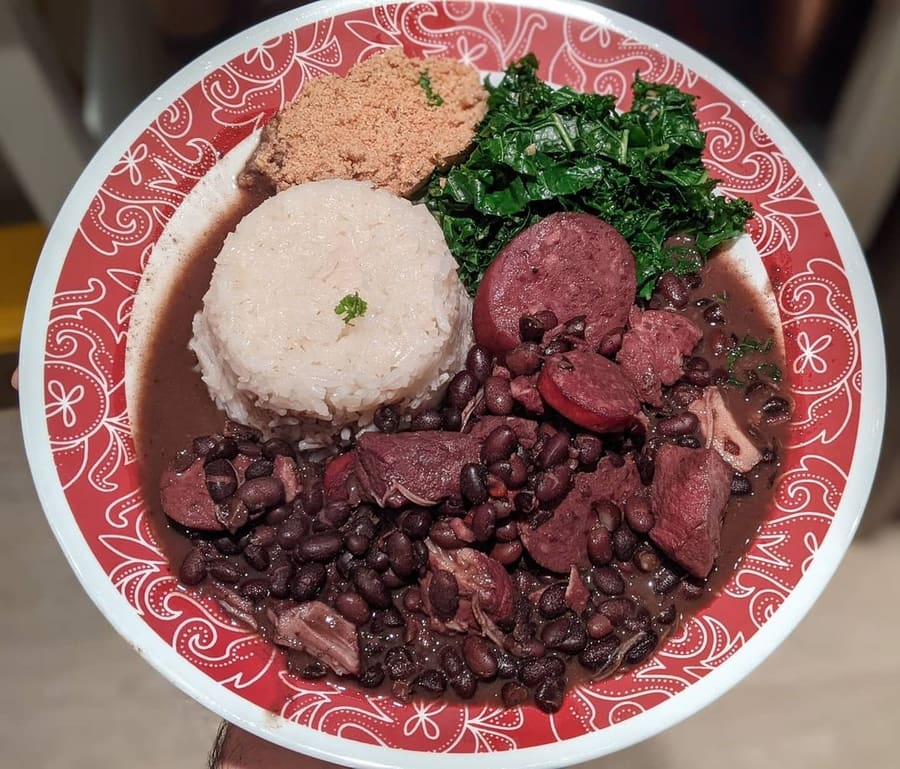
Empadão Goiano, stuffed with chicken, heart of palm, and pequi.
Bradleyzm · CC BY-SA 4.0highlights
landmark
Smooth grey rock formations carved by the San Miguel River. Wear shoes with firm grip on wet stone.
Demander à Parley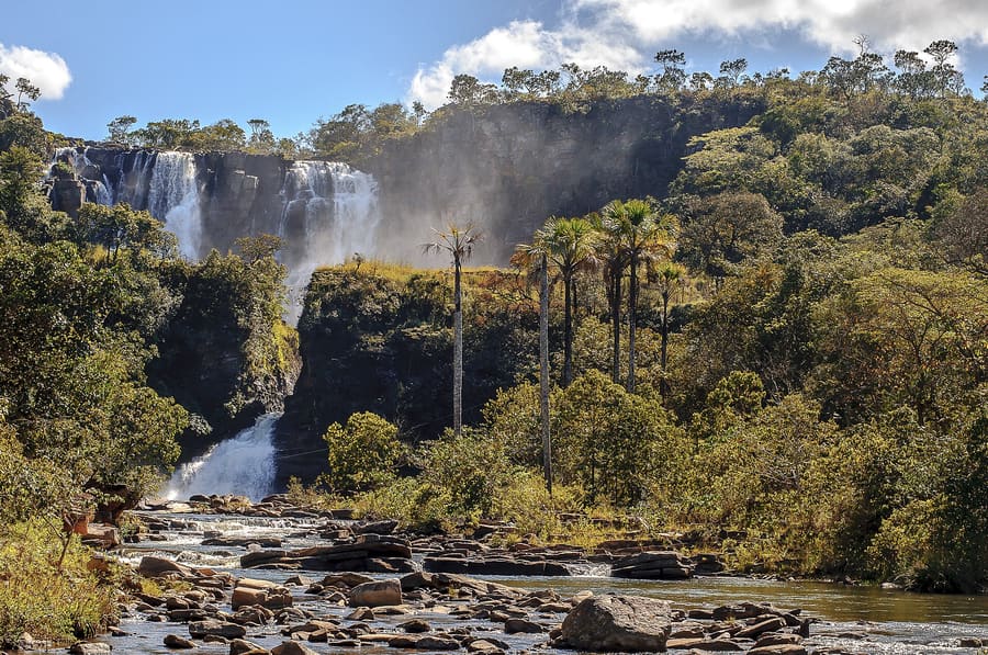
landmark
A 45-meter cliff plunge located inside Fazenda São Bento. Pay the day-use fee at the farm gate before entry.
Demander à Parley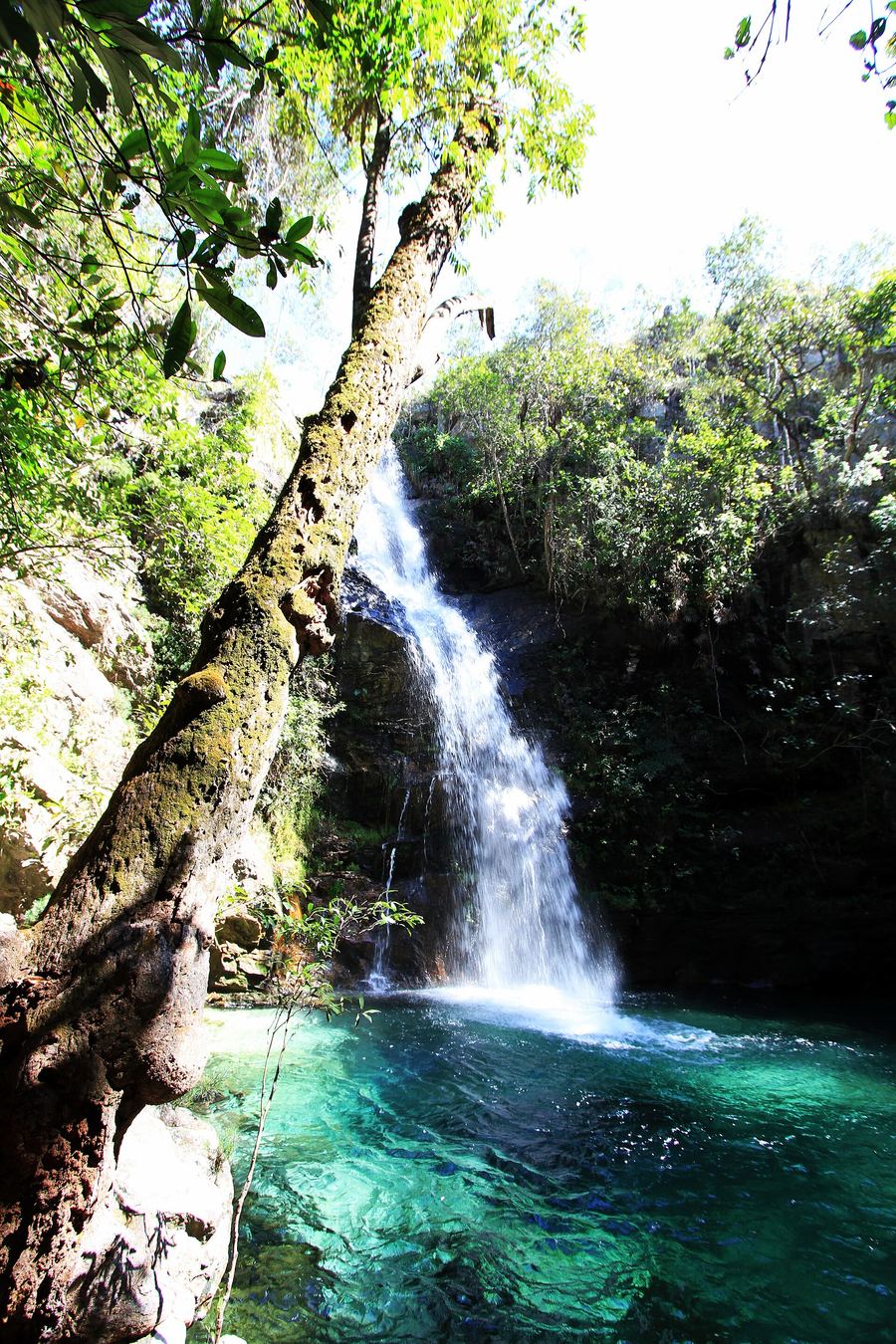
landmark
Turquoise pools linked by wooden boardwalks. It lies just 4 km from the town center, ideal for quick visits.
Demander à Parleyattractions
areas
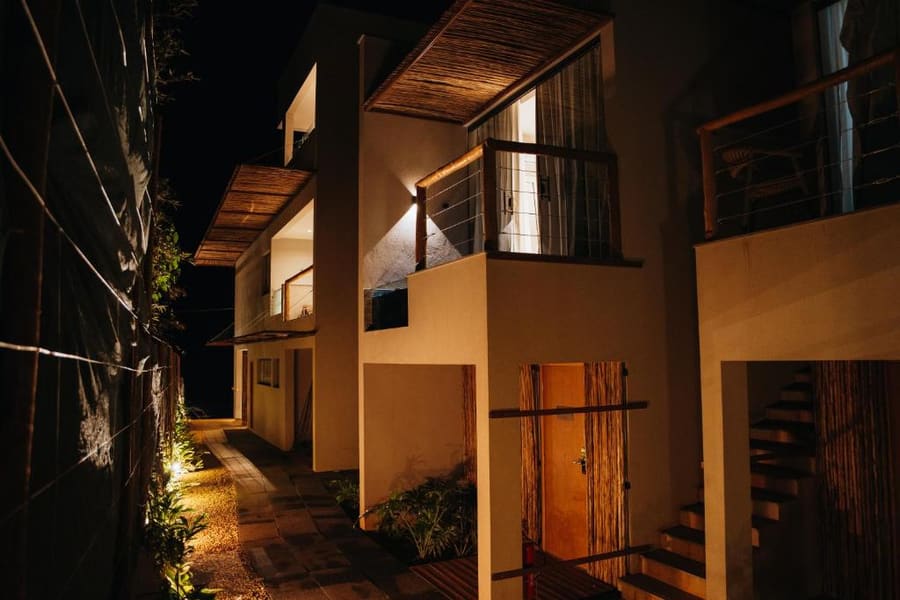
Secluded lodges and eco-resorts set in open Cerrado.
À proximitéFazenda São Bento and Almécegas falls.
Demander à ParleyPaved main street, restaurants, and crystal shops.
À proximitéSupermarkets and tour operator offices.
Demander à ParleyUnpaved sand lanes, dusty boots, and live reggae bars.
À proximitéChapada dos Veadeiros National Park gates.
Demander à ParleyTraditional farming community tucked between sheer ridge walls.
À proximitéSertãozinho stream and local organic farms.
Demander à Parleyfood
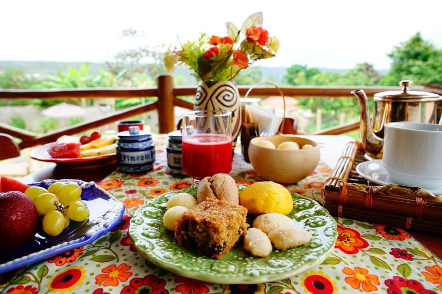
Dining in Alto Paraíso relies heavily on Goiano regional food mixed with vegetarian fare. Local kitchens heavily feature pequi, a pungent yellow fruit native to the Cerrado. Expect thick stews, galinhada, and savory pies named empadão goiano. Pousada breakfasts routinely feature cassava flatbreads and local cheeses.
Empadão Goiano, stuffed with chicken, heart of palm, and pequi.
Bradleyzm · CC BY-SA 4.0Order empadão goiano at small bakeries on Avenida Ary Valadão. It contains chicken, sausage, heart of palm, and olives.
Never bite directly into a pequi seed. Sharp inner spines will puncture your tongue; nibble the yellow outer flesh carefully.
Buy dried fruits and local nuts at the Feira Produtor market before heading out on full-day hikes.
history
Alto Paraíso began as an isolated cattle ranching and quartz mining outpost in the 18th century. Peak quartz extraction during World War II drew prospectors to the high plateau. In the 1970s, alternative communities moved in, drawn by claims of crystal energy along the 14th parallel. Today, national park protection limits mining while ecotourism drives the local economy.
Ranching origin
Cattle ranches established on the Veadeiros plateau.
Quartz mining
Commercial quartz extraction begins across the region.
Park created
President Juscelino Kubitschek creates Tocantins National Park, later renamed Chapada dos Veadeiros.
UNESCO status
UNESCO designates Chapada dos Veadeiros National Park a World Heritage site.
where to stay
Choose by your willingness to drive. Town center pousadas put restaurants within walking distance. São Jorge lodges put the national park trails right at your doorstep.
Live rates, matched to the areas above.
transport
Alto Paraíso has no commercial airport or municipal bus system. You arrive via Brasília and move around on unpaved roads.
Depuis Brasília International Airport (BSB)
Take highway BR-020 north then GO-118. A 4x4 is helpful but high clearance suffices.
Book in advance with local driver agencies; prices are per vehicle.
Public transit between waterfalls does not exist. You must hire a tour driver or rent a vehicle.
Fill your tank in Alto Paraíso town. Fuel stations across the outlying region are non-existent.
Check tyre pressure before driving to Couros or Macacão. Unpaved roads suffer sharp shale rocks.
cost
Prices peak during dry season weekends and national holidays. Cash remains essential for remote waterfall gates.
Federal park admission varies by residency status and covers all trails inside PNCV.
Landowners charge per person to access falls on private property like Almécegas or Loquinhas.
Daily rate for mandatory or optional guides split among groups of up to 8 people.
Standard lunch at casual town diners includes rice, beans, meat, and cassava.
seasonality
MAY – SEP
Dry season. Clear skies and ideal hiking conditions, but waterfall water levels drop by August.
OCT – NOV
First rains return. The landscape greens quickly and temperatures peak.
DEC – FEB
Heavy rainy season. Waterfalls run at full volume, but sudden flash floods can close river trails.
MAR – APR
Rains ease. Streams remain full and savanna wildflowers bloom across the plateau.
practicalities
Shade is rare on savanna trails. Carry a hat, UV shirt, and at least two liters of water.
Alto Paraíso has limited bank branches. Carry sufficient cash for remote entrance fees.
Heavy rain upstream causes sudden river swells. Evacuate water immediately if currents turn murky.
Wear closed-toe hiking boots with good grip. Wet river rocks and loose gravel cause frequent slips.
Signal drops completely outside town centers. Download offline maps before leaving your pousada.